Geospatial Scientist Resume

These Geospatial Scientist resume samples are designed to help you write a resume that gets noticed by hiring managers and passes applicant tracking systems (ATS) in Earth Sciences. Each example shows real formatting, section structure, and language you can adapt to your own background. When writing your own Geospatial Scientist resume, focus on highlighting geological mapping & field survey, petrography & mineralogy and seismic & geophysical data interpretation. Recruiters scan for these qualifications first, so they should appear early in your summary and experience sections. Use strong action verbs such as "mapped", "surveyed", "interpreted", "modeled" to describe your achievements, and quantify your impact wherever possible — percentages, dollar amounts, or time saved make your resume more convincing. A common mistake to avoid: writing a generic objective statement instead of a targeted geospatial scientist professional summary. Tailor your resume to each Geospatial Scientist position you apply for rather than using one generic version.

Geospatial Scientist Resume Template
View PDF
0.0 (0 ratings)

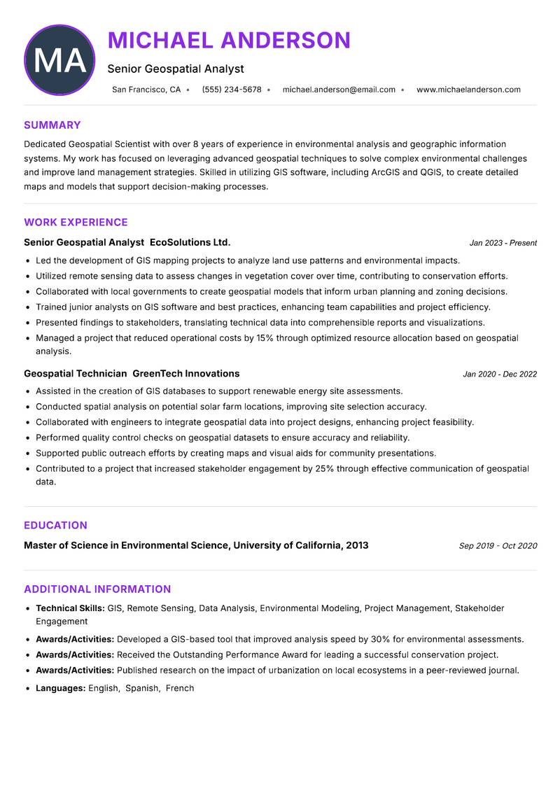
Senior Geospatial Analyst Resume

Dedicated Geospatial Scientist with over 8 years of experience in environmental analysis and geographic information systems. My work has focused on leveraging advanced geospatial techniques to solve complex environmental challenges and improve land management strategies. Skilled in utilizing GIS software, including ArcGIS and QGIS, to create detailed maps and models that support decision-making processes. My educational background in Environmental Science complements my technical skills, allowing me to approach geospatial projects with a holistic understanding of ecological impacts. I have successfully collaborated with interdisciplinary teams to design and implement geospatial solutions that enhance project outcomes and stakeholder engagement. Recognized for my innovative approach and ability to translate complex data into actionable insights, I am committed to fostering sustainable practices through the effective use of geospatial technology.

GIS Remote Sensing Data Analysis Environmental Modeling Project Management Stakeholder Engagement
Geospatial Scientist Resume Preview Example
View PDF
  1. Led the development of GIS mapping projects to analyze land use patterns and environmental impacts.
  2. Utilized remote sensing data to assess changes in vegetation cover over time, contributing to conservation efforts.
  3. Collaborated with local governments to create geospatial models that inform urban planning and zoning decisions.
  4. Trained junior analysts on GIS software and best practices, enhancing team capabilities and project efficiency.
  5. Presented findings to stakeholders, translating technical data into comprehensible reports and visualizations.
  6. Managed a project that reduced operational costs by 15% through optimized resource allocation based on geospatial analysis.
  1. Assisted in the creation of GIS databases to support renewable energy site assessments.
  2. Conducted spatial analysis on potential solar farm locations, improving site selection accuracy.
  3. Collaborated with engineers to integrate geospatial data into project designs, enhancing project feasibility.
  4. Performed quality control checks on geospatial datasets to ensure accuracy and reliability.
  5. Supported public outreach efforts by creating maps and visual aids for community presentations.
  6. Contributed to a project that increased stakeholder engagement by 25% through effective communication of geospatial data.

Achievements

  • Developed a GIS-based tool that improved analysis speed by 30% for environmental assessments.
  • Received the Outstanding Performance Award for leading a successful conservation project.
  • Published research on the impact of urbanization on local ecosystems in a peer-reviewed journal.
⏱️
Experience
2-5 Years
📅
Level
Mid Level
🎓
Education
Master of Science in Environme...

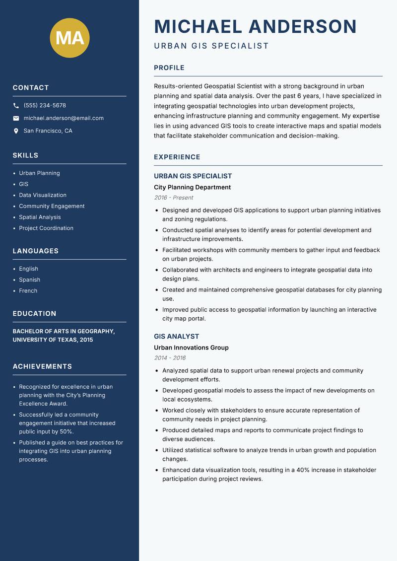
Urban GIS Specialist Resume

Accomplished Geospatial Scientist with a strong background in urban planning and spatial data analysis. Over the past 6 years, I have specialized in integrating geospatial technologies into urban development projects, enhancing infrastructure planning and community engagement. My expertise lies in using advanced GIS tools to create interactive maps and spatial models that facilitate stakeholder communication and decision-making. I have a proven track record of collaborating with governmental agencies and non-profits to develop sustainable urban solutions. My ability to analyze complex spatial data and present findings in a clear, actionable manner has led to successful project outcomes. I am passionate about using geospatial science to create livable, sustainable cities and improve the quality of life for residents.

Urban Planning GIS Data Visualization Community Engagement Spatial Analysis Project Coordination
Geospatial Scientist Resume Preview Example
View PDF
  1. Designed and developed GIS applications to support urban planning initiatives and zoning regulations.
  2. Conducted spatial analyses to identify areas for potential development and infrastructure improvements.
  3. Facilitated workshops with community members to gather input and feedback on urban projects.
  4. Collaborated with architects and engineers to integrate geospatial data into design plans.
  5. Created and maintained comprehensive geospatial databases for city planning use.
  6. Improved public access to geospatial information by launching an interactive city map portal.
  1. Analyzed spatial data to support urban renewal projects and community development efforts.
  2. Developed geospatial models to assess the impact of new developments on local ecosystems.
  3. Worked closely with stakeholders to ensure accurate representation of community needs in project planning.
  4. Produced detailed maps and reports to communicate project findings to diverse audiences.
  5. Utilized statistical software to analyze trends in urban growth and population changes.
  6. Enhanced data visualization tools, resulting in a 40% increase in stakeholder participation during project reviews.

Achievements

  • Recognized for excellence in urban planning with the City’s Planning Excellence Award.
  • Successfully led a community engagement initiative that increased public input by 50%.
  • Published a guide on best practices for integrating GIS into urban planning processes.
⏱️
Experience
2-5 Years
📅
Level
Mid Level
🎓
Education
Bachelor of Arts in Geography,...

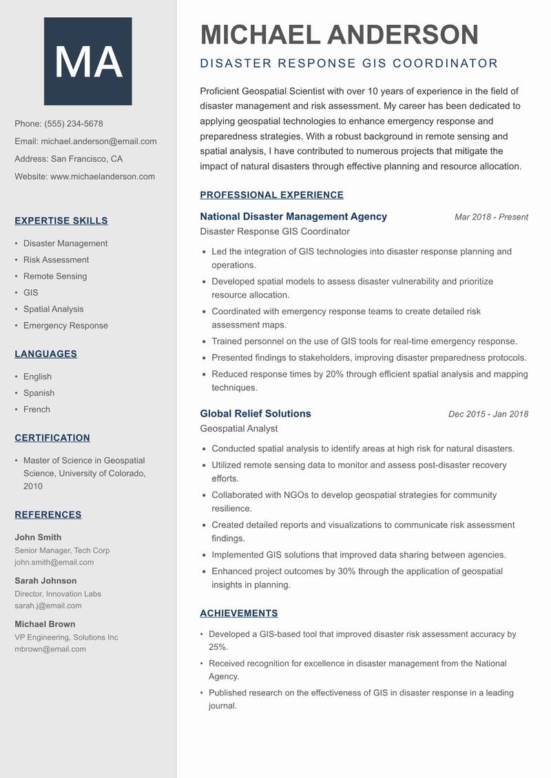
Disaster Response GIS Coordinator Resume

Proficient Geospatial Scientist with over 10 years of experience in the field of disaster management and risk assessment. My career has been dedicated to applying geospatial technologies to enhance emergency response and preparedness strategies. With a robust background in remote sensing and spatial analysis, I have contributed to numerous projects that mitigate the impact of natural disasters through effective planning and resource allocation. I excel at using GIS tools to model disaster scenarios and analyze vulnerabilities within communities. My collaborative approach has fostered partnerships with various organizations and governmental agencies, enhancing disaster resilience efforts. I am committed to improving community safety through the innovative application of geospatial science.

Disaster Management Risk Assessment Remote Sensing GIS Spatial Analysis Emergency Response
Geospatial Scientist Resume Preview Example
View PDF
  1. Led the integration of GIS technologies into disaster response planning and operations.
  2. Developed spatial models to assess disaster vulnerability and prioritize resource allocation.
  3. Coordinated with emergency response teams to create detailed risk assessment maps.
  4. Trained personnel on the use of GIS tools for real-time emergency response.
  5. Presented findings to stakeholders, improving disaster preparedness protocols.
  6. Reduced response times by 20% through efficient spatial analysis and mapping techniques.
  1. Conducted spatial analysis to identify areas at high risk for natural disasters.
  2. Utilized remote sensing data to monitor and assess post-disaster recovery efforts.
  3. Collaborated with NGOs to develop geospatial strategies for community resilience.
  4. Created detailed reports and visualizations to communicate risk assessment findings.
  5. Implemented GIS solutions that improved data sharing between agencies.
  6. Enhanced project outcomes by 30% through the application of geospatial insights in planning.

Achievements

  • Developed a GIS-based tool that improved disaster risk assessment accuracy by 25%.
  • Received recognition for excellence in disaster management from the National Agency.
  • Published research on the effectiveness of GIS in disaster response in a leading journal.
⏱️
Experience
2-5 Years
📅
Level
Mid Level
🎓
Education
Master of Science in Geospatia...

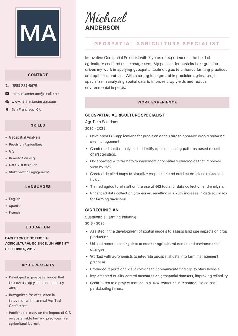
Geospatial Agriculture Specialist Resume

Innovative Geospatial Scientist with 7 years of experience in the field of agriculture and land use management. My passion for sustainable agriculture drives my work in applying geospatial technologies to enhance farming practices and optimize land use. With a strong background in precision agriculture, I specialize in analyzing spatial data to improve crop yields and reduce environmental impacts. My expertise includes using GIS tools to create detailed maps that inform farmers' decisions regarding resource allocation and crop management. By collaborating with agricultural stakeholders, I have successfully implemented geospatial solutions that have increased productivity and sustainability in farming operations. I am committed to advancing sustainable farming through the effective application of geospatial science.

Geospatial Analysis Precision Agriculture GIS Remote Sensing Data Visualization Stakeholder Engagement
Geospatial Scientist Resume Preview Example
View PDF
  1. Developed GIS applications for precision agriculture to enhance crop monitoring and management.
  2. Conducted spatial analyses to identify optimal planting patterns based on soil characteristics.
  3. Collaborated with farmers to implement geospatial technologies that improved yield by 15%.
  4. Created detailed maps to visualize crop health and nutrient deficiencies across fields.
  5. Trained agricultural staff on the use of GIS tools for data collection and analysis.
  6. Enhanced data collection processes, resulting in a 20% increase in data accuracy for farming decisions.
  1. Assisted in the development of spatial models to assess land use impacts on crop production.
  2. Utilized remote sensing data to monitor agricultural trends and environmental changes.
  3. Worked with agronomists to integrate geospatial data into farm management practices.
  4. Produced reports and visualizations to communicate findings to stakeholders.
  5. Implemented quality control measures on geospatial datasets, improving reliability.
  6. Contributed to a project that led to a 30% reduction in resource use across participating farms.

Achievements

  • Developed a geospatial model that improved crop yield predictions by 40%.
  • Recognized for excellence in innovation at the annual AgriTech Conference.
  • Published a study on the impact of GIS on sustainable farming practices in an agricultural journal.
⏱️
Experience
2-5 Years
📅
Level
Mid Level
🎓
Education
Bachelor of Science in Agricul...

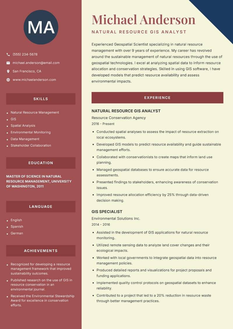
Natural Resource GIS Analyst Resume

Experienced Geospatial Scientist specializing in natural resource management with over 9 years of experience. My career has revolved around the sustainable management of natural resources through the use of geospatial technologies. I excel at analyzing spatial data to inform resource allocation and conservation strategies. Skilled in using GIS software, I have developed models that predict resource availability and assess environmental impacts. My ability to work collaboratively with environmental agencies and stakeholders has led to successful conservation initiatives. I am passionate about utilizing geospatial science to promote sustainable practices and ensure the responsible use of natural resources.

Natural Resource Management GIS Spatial Analysis Environmental Monitoring Data Management Stakeholder Collaboration
Geospatial Scientist Resume Preview Example
View PDF
  1. Conducted spatial analyses to assess the impact of resource extraction on local ecosystems.
  2. Developed GIS models to predict resource availability and guide sustainable management efforts.
  3. Collaborated with conservationists to create maps that inform land use planning.
  4. Managed geospatial databases to ensure accurate data for resource assessments.
  5. Presented findings to stakeholders, enhancing awareness of conservation issues.
  6. Improved resource allocation efficiency by 25% through data-driven decision making.
  1. Assisted in the development of GIS applications for natural resource monitoring.
  2. Utilized remote sensing data to analyze land cover changes and their ecological impacts.
  3. Worked with local governments to integrate geospatial data into resource management policies.
  4. Produced detailed reports and visualizations for project proposals and funding applications.
  5. Implemented quality control protocols on geospatial datasets to enhance reliability.
  6. Contributed to a project that led to a 20% reduction in resource waste through better management practices.

Achievements

  • Recognized for developing a resource management framework that improved sustainability outcomes.
  • Published research on the use of GIS in resource conservation in an environmental journal.
  • Received the Environmental Stewardship Award for excellence in conservation efforts.
⏱️
Experience
2-5 Years
📅
Level
Mid Level
🎓
Education
Master of Science in Natural R...

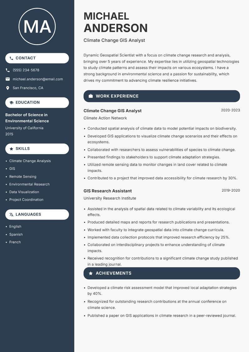
Climate Change GIS Analyst Resume

Dynamic Geospatial Scientist with a focus on climate change research and analysis, bringing over 5 years of experience. My expertise lies in utilizing geospatial technologies to study climate patterns and assess their impacts on various ecosystems. I have a strong background in environmental science and a passion for sustainability, which drives my commitment to advancing climate resilience initiatives. Proficient in GIS and remote sensing, I have developed models that predict climate-related risks and inform adaptation strategies. My collaborative approach has enabled successful partnerships with academic institutions and governmental bodies, enhancing the effectiveness of climate action plans. I am dedicated to leveraging geospatial science to mitigate the effects of climate change.

Climate Change Analysis GIS Remote Sensing Environmental Research Data Visualization Project Coordination
Geospatial Scientist Resume Preview Example
View PDF
  1. Conducted spatial analysis of climate data to model potential impacts on biodiversity.
  2. Developed GIS applications to visualize climate change scenarios and their effects on ecosystems.
  3. Collaborated with researchers to assess vulnerabilities of species to climate change.
  4. Presented findings to stakeholders to support climate adaptation strategies.
  5. Utilized remote sensing data to monitor changes in land cover related to climate impacts.
  6. Contributed to a project that improved data accessibility for climate research by 30%.
  1. Assisted in the analysis of spatial data related to climate variability and its ecological effects.
  2. Produced detailed maps and reports for research publications and presentations.
  3. Worked with faculty to integrate geospatial data into climate change curricula.
  4. Implemented data collection protocols that improved research efficiency by 25%.
  5. Collaborated on interdisciplinary projects to enhance understanding of climate impacts.
  6. Received recognition for contributions to a significant climate change study published in a leading journal.

Achievements

  • Developed a climate risk assessment model that improved local adaptation strategies by 40%.
  • Recognized for outstanding research contributions at the annual conference on climate science.
  • Published a paper on GIS applications in climate research in a peer-reviewed journal.
⏱️
Experience
2-5 Years
📅
Level
Mid Level
🎓
Education
Bachelor of Science in Environ...

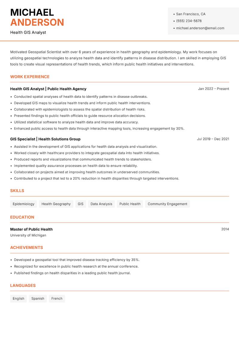
Health GIS Analyst Resume

Driven Geospatial Scientist with over 6 years of experience in health geography and epidemiology. My work focuses on utilizing geospatial technologies to analyze health data and identify patterns in disease distribution. I am skilled in employing GIS tools to create visual representations of health trends, which inform public health initiatives and interventions. With a strong foundation in public health and spatial analysis, I have collaborated with healthcare organizations to improve health outcomes through data-driven decision-making. My commitment to leveraging geospatial science to address health disparities has led to successful collaborations with various stakeholders, enhancing community health strategies. I am passionate about the intersection of geography and health, and I strive to use my skills to promote healthier communities.

Epidemiology Health Geography GIS Data Analysis Public Health Community Engagement
Geospatial Scientist Resume Preview Example
View PDF
  1. Conducted spatial analyses of health data to identify patterns in disease outbreaks.
  2. Developed GIS maps to visualize health trends and inform public health interventions.
  3. Collaborated with epidemiologists to assess the spatial distribution of health risks.
  4. Presented findings to public health officials to guide resource allocation decisions.
  5. Utilized statistical software to analyze health data and improve data accuracy.
  6. Enhanced public access to health data through interactive mapping tools, increasing engagement by 30%.
  1. Assisted in the development of GIS applications for health data analysis and visualization.
  2. Worked closely with healthcare providers to integrate geospatial data into health initiatives.
  3. Produced reports and visualizations that communicated health trends to stakeholders.
  4. Implemented quality assurance processes on health data to ensure reliability.
  5. Collaborated on projects aimed at improving health outcomes in underserved communities.
  6. Contributed to a project that led to a 20% reduction in health disparities through targeted interventions.

Achievements

  • Developed a geospatial tool that improved disease tracking efficiency by 35%.
  • Recognized for excellence in public health research at the annual conference.
  • Published findings on health disparities in a leading public health journal.
⏱️
Experience
2-5 Years
📅
Level
Mid Level
🎓
Education
Master of Public Health, Unive...

Key Skills for Geospatial Scientist Positions

Resume Tips for Geospatial Scientist Applications

Strong Action Verbs for Geospatial Scientist Resumes

Mapped · Surveyed · Interpreted · Modeled · Analyzed · Investigated · Drilled · Characterized · Published · Assessed · Achieved · Administered · Architected · Automated

Common Mistakes to Avoid

Experience Levels

How to Write a Geospatial Scientist Resume

Browse Geospatial Scientist resume examples built around geological mapping & field survey, tailored for Earth Sciences roles.

A strong Geospatial Scientist resume leads with a focused professional summary that names the exact role and your standout achievement. In the experience section, open every bullet with a strong action verb and quantify the result with numbers wherever possible. Highlight your most relevant competencies — especially Geological Mapping & Field Survey, Petrography & Mineralogy, and Seismic & Geophysical Data Interpretation — in a dedicated Skills section positioned early so ATS systems and hiring managers both find it immediately.

For format, most Geospatial Scientist roles suit a reverse-chronological layout: most recent position first, working backwards. Keep to one page for under five years of experience, or two pages for senior candidates with a rich project or leadership history. Use clean, ATS-safe fonts (10–12pt), standard section headings (Summary, Experience, Education, Skills), and avoid tables, text boxes, or multi-column layouts that applicant tracking systems cannot parse reliably.
Frequently Asked Questions

What makes a strong Geospatial Scientist resume stand out to employers?

A standout Geospatial Scientist resume combines role-specific skills with quantified achievements. Name the exact job title in your professional summary, mirror keywords from each job posting, and open every bullet point with a strong action verb followed by a measurable result. Certifications, tools, and domain experience specific to geospatial scientist roles should appear prominently near the top.

What skills are most important to include on a Earth Sciences resume?

Recruiters hiring in Earth Sciences consistently look for Geological Mapping & Field Survey, Petrography & Mineralogy, Seismic & Geophysical Data Interpretation, GIS & Remote Sensing (ArcGIS, QGIS). List these in a dedicated Skills section near the top so both ATS systems and human reviewers spot them fast. Mirror the exact phrasing from each job posting wherever possible — many applicant tracking systems match literal strings rather than synonyms.

What is the best resume format for Earth Sciences professionals?

A reverse-chronological format is the standard choice for most Earth Sciences candidates — employers expect to see your most recent role first, working backwards. If you are transitioning into Earth Sciences from a related field, a hybrid format (brief skills summary at the top followed by chronological experience) can bridge the gap effectively. Keep the document to one page for under five years of experience, or two pages for senior specialists.

How do I make my Earth Sciences resume pass applicant tracking systems (ATS)?

Use standard section headings — Summary, Experience, Education, Skills — rather than creative labels that ATS parsers do not recognise. Embed domain keywords such as "Geological Mapping & Field Survey" and "Petrography & Mineralogy" naturally inside your experience bullets rather than cramming them into a standalone keyword list. Avoid tables, multi-column layouts, text boxes, headers, footers, and images — these confuse most modern parsers and can cause your resume to be misread or rejected before a human sees it.

What mistakes do Earth Sciences professionals most commonly make on their resume?

The most frequent issue is not specifying field environments — offshore vs. tropical vs. arctic geology are very different competencies. Beyond that, generic objective statements, unquantified achievements, and inconsistent date formatting appear across almost every Earth Sciences application. Fix these by replacing every vague claim with a measurable outcome — specific numbers and named projects add credibility that adjectives cannot.

How long should a Earth Sciences resume be?

One page is appropriate for candidates with under five years of relevant Earth Sciences experience. Two pages are acceptable — and sometimes expected — for senior specialists, managers, or professionals with a strong portfolio of projects, publications, or credentials. Avoid padding to reach a page count: every line should directly support your application for the specific role you are targeting.

Should I include a professional summary at the top of my Earth Sciences resume?

Yes — a two to three sentence summary is the first section most recruiters read. Open with your title and years of Earth Sciences experience, then name your most relevant achievement or specialisation. One proven approach: Specify field experience including environments worked in (desert, offshore, Arctic) and duration — this level of specificity signals genuine expertise before a recruiter reaches your experience section.

Scroll to view samples