Land Surveyor Resume

These Land Surveyor resume samples are designed to help you write a resume that gets noticed by hiring managers and passes applicant tracking systems (ATS) in Valuation & Surveying. Each example shows real formatting, section structure, and language you can adapt to your own background. When writing your own Land Surveyor resume, focus on highlighting smart infrastructure design\, IoT & sensor networks\ and urban data analytics\. Recruiters scan for these qualifications first, so they should appear early in your summary and experience sections. Use strong action verbs such as "designed\", "implemented\", "analysed\", "integrated\" to describe your achievements, and quantify your impact wherever possible — percentages, dollar amounts, or time saved make your resume more convincing. A common mistake to avoid: writing a generic objective statement instead of a targeted land surveyor professional summary. Tailor your resume to each Land Surveyor position you apply for rather than using one generic version.

Land Surveyor Resume Template
View PDF
0.0 (0 ratings)

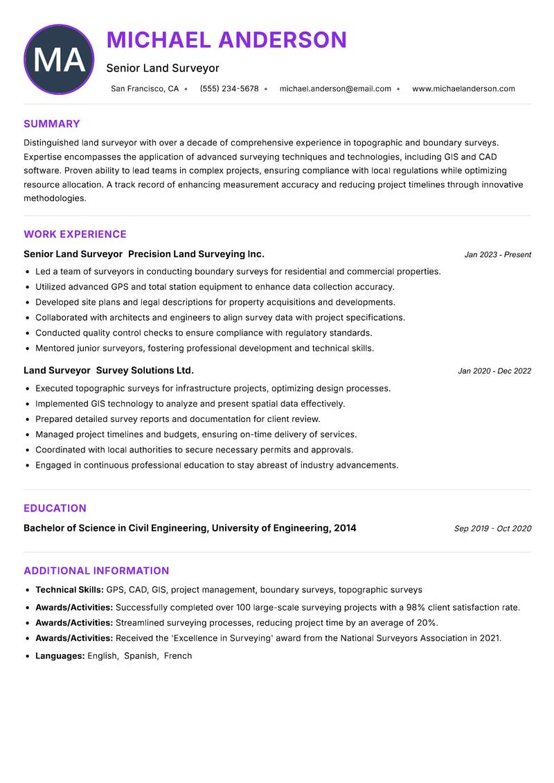
Senior Land Surveyor Resume

Distinguished land surveyor with over a decade of comprehensive experience in topographic and boundary surveys. Expertise encompasses the application of advanced surveying techniques and technologies, including GIS and CAD software. Proven ability to lead teams in complex projects, ensuring compliance with local regulations while optimizing resource allocation. A track record of enhancing measurement accuracy and reducing project timelines through innovative methodologies. Strong analytical and problem-solving skills, complemented by a commitment to maintaining the highest standards of quality. Recognized for exceptional client relations and project management capabilities, ensuring stakeholder satisfaction and project success.

GPS CAD GIS project management boundary surveys topographic surveys
Land Surveyor Resume Preview Example
View PDF
  1. Led a team of surveyors in conducting boundary surveys for residential and commercial properties.
  2. Utilized advanced GPS and total station equipment to enhance data collection accuracy.
  3. Developed site plans and legal descriptions for property acquisitions and developments.
  4. Collaborated with architects and engineers to align survey data with project specifications.
  5. Conducted quality control checks to ensure compliance with regulatory standards.
  6. Mentored junior surveyors, fostering professional development and technical skills.
  1. Executed topographic surveys for infrastructure projects, optimizing design processes.
  2. Implemented GIS technology to analyze and present spatial data effectively.
  3. Prepared detailed survey reports and documentation for client review.
  4. Managed project timelines and budgets, ensuring on-time delivery of services.
  5. Coordinated with local authorities to secure necessary permits and approvals.
  6. Engaged in continuous professional education to stay abreast of industry advancements.

Achievements

  • Successfully completed over 100 large-scale surveying projects with a 98% client satisfaction rate.
  • Streamlined surveying processes, reducing project time by an average of 20%.
  • Received the 'Excellence in Surveying' award from the National Surveyors Association in 2021.
⏱️
Experience
2-5 Years
📅
Level
Mid Level
🎓
Education
Bachelor of Science in Civil E...

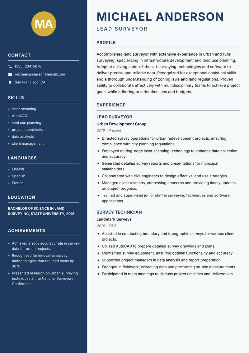
Lead Surveyor Resume

Accomplished land surveyor with extensive experience in urban and rural surveying, specializing in infrastructure development and land use planning. Adept at utilizing state-of-the-art surveying technologies and software to deliver precise and reliable data. Recognized for exceptional analytical skills and a thorough understanding of zoning laws and land regulations. Proven ability to collaborate effectively with multidisciplinary teams to achieve project goals while adhering to strict timelines and budgets. Strong communication skills facilitate clear reporting and client relations, ensuring project transparency and stakeholder engagement. Committed to advancing the profession through continuous learning and professional development.

laser scanning AutoCAD land use planning project coordination data analysis client management
Land Surveyor Resume Preview Example
View PDF
  1. Directed survey operations for urban redevelopment projects, ensuring compliance with city planning regulations.
  2. Employed cutting-edge laser scanning technology to enhance data collection and accuracy.
  3. Generated detailed survey reports and presentations for municipal stakeholders.
  4. Collaborated with civil engineers to design effective land use strategies.
  5. Managed client relations, addressing concerns and providing timely updates on project progress.
  6. Trained and supervised junior staff in surveying techniques and software applications.
  1. Assisted in conducting boundary and topographic surveys for various client projects.
  2. Utilized AutoCAD to prepare detailed survey drawings and plans.
  3. Maintained survey equipment, ensuring optimal functionality and accuracy.
  4. Supported project managers in data analysis and report preparation.
  5. Engaged in fieldwork, collecting data and performing on-site measurements.
  6. Participated in team meetings to discuss project timelines and deliverables.

Achievements

  • Achieved a 95% accuracy rate in survey data for urban projects.
  • Recognized for innovative survey methodologies that reduced costs by 30%.
  • Presented research on urban surveying techniques at the National Surveyors Conference.
⏱️
Experience
2-5 Years
📅
Level
Mid Level
🎓
Education
Bachelor of Science in Land Su...

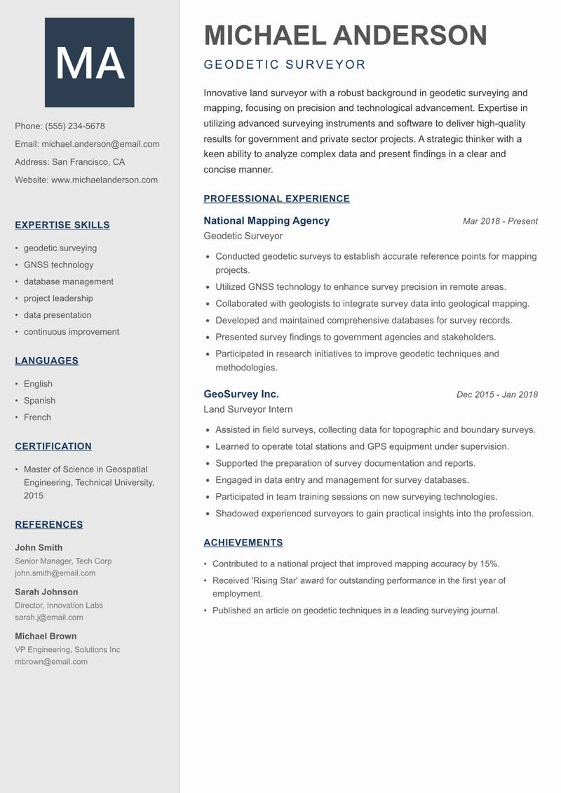
Geodetic Surveyor Resume

Innovative land surveyor with a robust background in geodetic surveying and mapping, focusing on precision and technological advancement. Expertise in utilizing advanced surveying instruments and software to deliver high-quality results for government and private sector projects. A strategic thinker with a keen ability to analyze complex data and present findings in a clear and concise manner. Strong project management skills, with a history of leading cross-functional teams to successful project completion. Committed to fostering relationships with clients and stakeholders through transparent communication and exceptional service delivery. Continuous pursuit of professional development and industry knowledge ensures up-to-date practices in land surveying.

geodetic surveying GNSS technology database management project leadership data presentation continuous improvement
Land Surveyor Resume Preview Example
View PDF
  1. Conducted geodetic surveys to establish accurate reference points for mapping projects.
  2. Utilized GNSS technology to enhance survey precision in remote areas.
  3. Collaborated with geologists to integrate survey data into geological mapping.
  4. Developed and maintained comprehensive databases for survey records.
  5. Presented survey findings to government agencies and stakeholders.
  6. Participated in research initiatives to improve geodetic techniques and methodologies.
  1. Assisted in field surveys, collecting data for topographic and boundary surveys.
  2. Learned to operate total stations and GPS equipment under supervision.
  3. Supported the preparation of survey documentation and reports.
  4. Engaged in data entry and management for survey databases.
  5. Participated in team training sessions on new surveying technologies.
  6. Shadowed experienced surveyors to gain practical insights into the profession.

Achievements

  • Contributed to a national project that improved mapping accuracy by 15%.
  • Received 'Rising Star' award for outstanding performance in the first year of employment.
  • Published an article on geodetic techniques in a leading surveying journal.
⏱️
Experience
2-5 Years
📅
Level
Mid Level
🎓
Education
Master of Science in Geospatia...

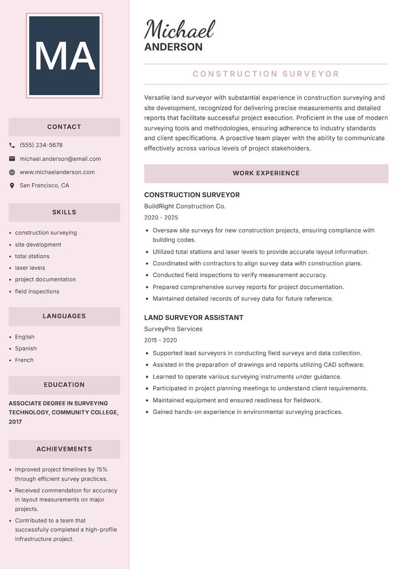
Construction Surveyor Resume

Versatile land surveyor with substantial experience in construction surveying and site development, recognized for delivering precise measurements and detailed reports that facilitate successful project execution. Proficient in the use of modern surveying tools and methodologies, ensuring adherence to industry standards and client specifications. A proactive team player with the ability to communicate effectively across various levels of project stakeholders. Strong organizational skills combined with a detail-oriented approach enable the management of multiple projects simultaneously while maintaining high-quality outcomes. Dedicated to continuous professional growth and contributing to the advancement of land surveying practices through innovative solutions.

construction surveying site development total stations laser levels project documentation field inspections
Land Surveyor Resume Preview Example
View PDF
  1. Oversaw site surveys for new construction projects, ensuring compliance with building codes.
  2. Utilized total stations and laser levels to provide accurate layout information.
  3. Coordinated with contractors to align survey data with construction plans.
  4. Conducted field inspections to verify measurement accuracy.
  5. Prepared comprehensive survey reports for project documentation.
  6. Maintained detailed records of survey data for future reference.
  1. Supported lead surveyors in conducting field surveys and data collection.
  2. Assisted in the preparation of drawings and reports utilizing CAD software.
  3. Learned to operate various surveying instruments under guidance.
  4. Participated in project planning meetings to understand client requirements.
  5. Maintained equipment and ensured readiness for fieldwork.
  6. Gained hands-on experience in environmental surveying practices.

Achievements

  • Improved project timelines by 15% through efficient survey practices.
  • Received commendation for accuracy in layout measurements on major projects.
  • Contributed to a team that successfully completed a high-profile infrastructure project.
⏱️
Experience
2-5 Years
📅
Level
Mid Level
🎓
Education
Associate Degree in Surveying ...

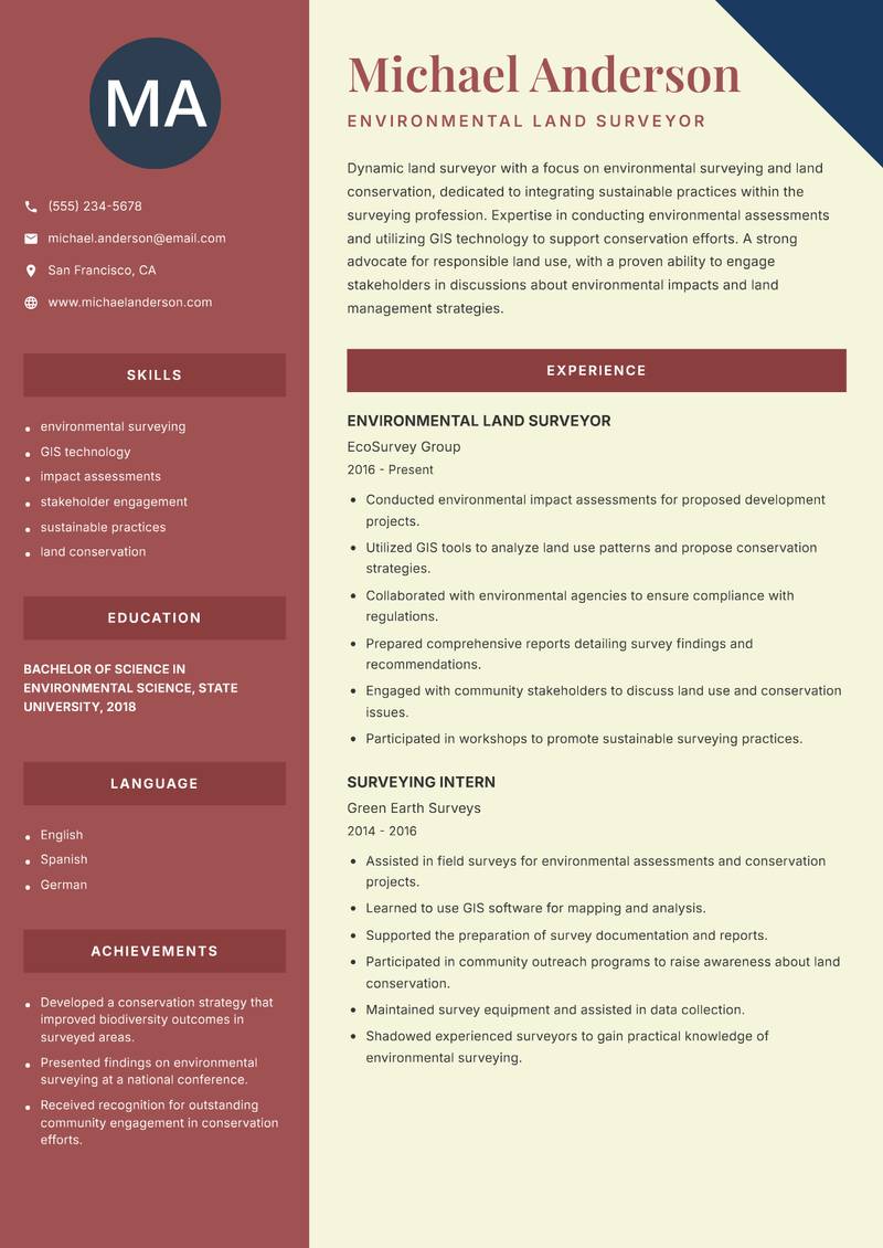
Environmental Land Surveyor Resume

Dynamic land surveyor with a focus on environmental surveying and land conservation, dedicated to integrating sustainable practices within the surveying profession. Expertise in conducting environmental assessments and utilizing GIS technology to support conservation efforts. A strong advocate for responsible land use, with a proven ability to engage stakeholders in discussions about environmental impacts and land management strategies. Skilled in preparing detailed reports that convey complex information clearly and effectively. Committed to continuous professional development, actively seeking opportunities to enhance knowledge of sustainable surveying practices and technologies.

environmental surveying GIS technology impact assessments stakeholder engagement sustainable practices land conservation
Land Surveyor Resume Preview Example
View PDF
  1. Conducted environmental impact assessments for proposed development projects.
  2. Utilized GIS tools to analyze land use patterns and propose conservation strategies.
  3. Collaborated with environmental agencies to ensure compliance with regulations.
  4. Prepared comprehensive reports detailing survey findings and recommendations.
  5. Engaged with community stakeholders to discuss land use and conservation issues.
  6. Participated in workshops to promote sustainable surveying practices.
  1. Assisted in field surveys for environmental assessments and conservation projects.
  2. Learned to use GIS software for mapping and analysis.
  3. Supported the preparation of survey documentation and reports.
  4. Participated in community outreach programs to raise awareness about land conservation.
  5. Maintained survey equipment and assisted in data collection.
  6. Shadowed experienced surveyors to gain practical knowledge of environmental surveying.

Achievements

  • Developed a conservation strategy that improved biodiversity outcomes in surveyed areas.
  • Presented findings on environmental surveying at a national conference.
  • Received recognition for outstanding community engagement in conservation efforts.
⏱️
Experience
2-5 Years
📅
Level
Mid Level
🎓
Education
Bachelor of Science in Environ...

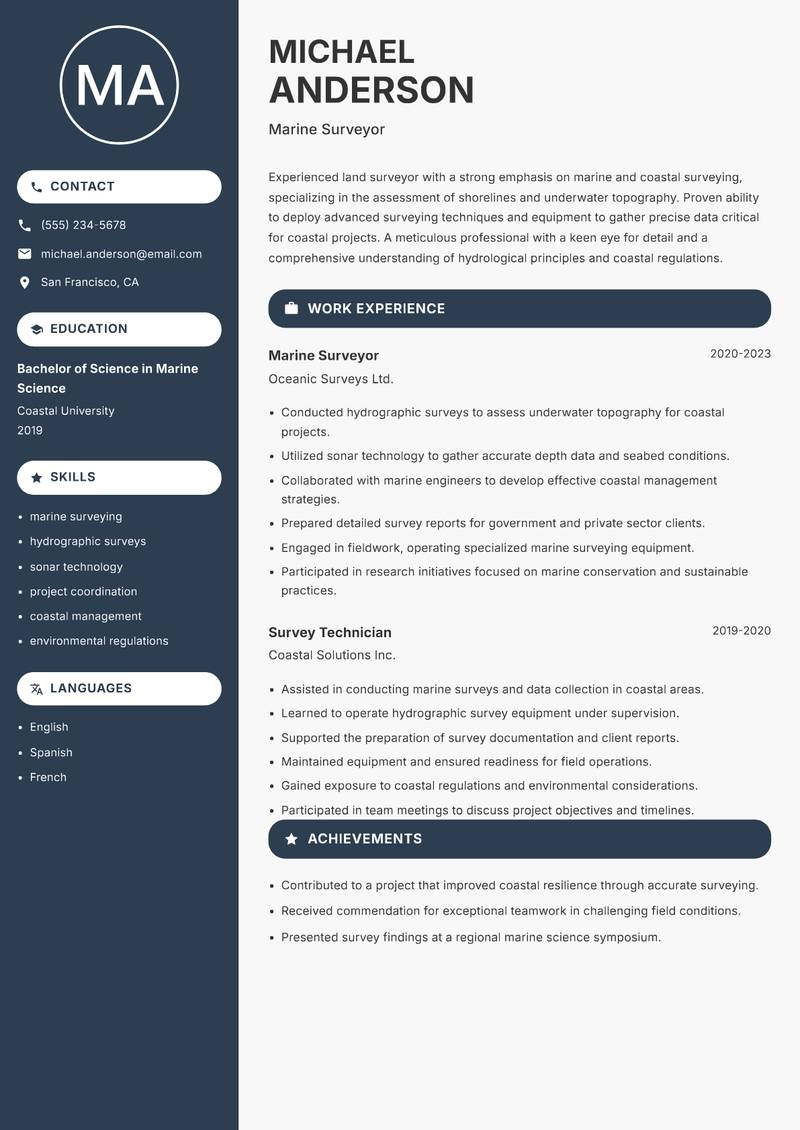
Marine Surveyor Resume

Experienced land surveyor with a strong emphasis on marine and coastal surveying, specializing in the assessment of shorelines and underwater topography. Proven ability to deploy advanced surveying techniques and equipment to gather precise data critical for coastal projects. A meticulous professional with a keen eye for detail and a comprehensive understanding of hydrological principles and coastal regulations. Exceptional project management capabilities allow for the successful coordination of multidisciplinary teams in challenging environments. Committed to advancing marine surveying practices through ongoing education and adaptation to emerging technologies.

marine surveying hydrographic surveys sonar technology project coordination coastal management environmental regulations
Land Surveyor Resume Preview Example
View PDF
  1. Conducted hydrographic surveys to assess underwater topography for coastal projects.
  2. Utilized sonar technology to gather accurate depth data and seabed conditions.
  3. Collaborated with marine engineers to develop effective coastal management strategies.
  4. Prepared detailed survey reports for government and private sector clients.
  5. Engaged in fieldwork, operating specialized marine surveying equipment.
  6. Participated in research initiatives focused on marine conservation and sustainable practices.
  1. Assisted in conducting marine surveys and data collection in coastal areas.
  2. Learned to operate hydrographic survey equipment under supervision.
  3. Supported the preparation of survey documentation and client reports.
  4. Maintained equipment and ensured readiness for field operations.
  5. Gained exposure to coastal regulations and environmental considerations.
  6. Participated in team meetings to discuss project objectives and timelines.

Achievements

  • Contributed to a project that improved coastal resilience through accurate surveying.
  • Received commendation for exceptional teamwork in challenging field conditions.
  • Presented survey findings at a regional marine science symposium.
⏱️
Experience
2-5 Years
📅
Level
Mid Level
🎓
Education
Bachelor of Science in Marine ...

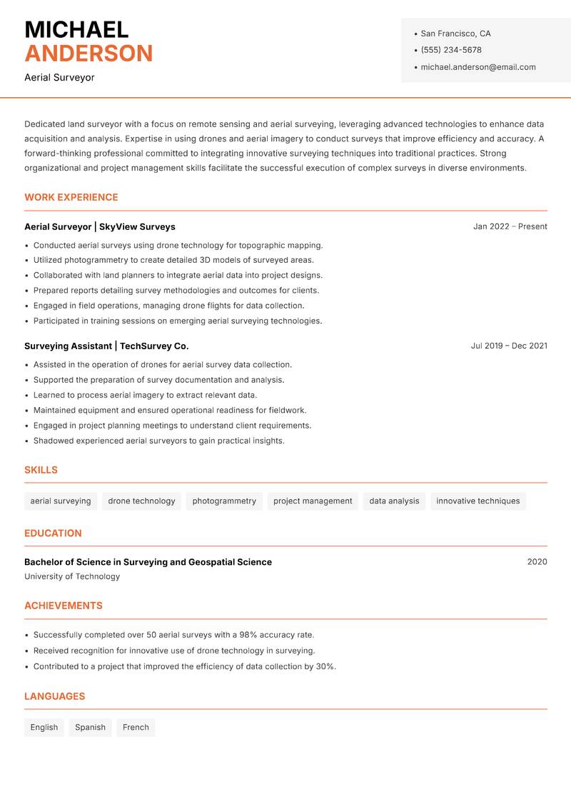
Aerial Surveyor Resume

Dedicated land surveyor with a focus on remote sensing and aerial surveying, leveraging advanced technologies to enhance data acquisition and analysis. Expertise in using drones and aerial imagery to conduct surveys that improve efficiency and accuracy. A forward-thinking professional committed to integrating innovative surveying techniques into traditional practices. Strong organizational and project management skills facilitate the successful execution of complex surveys in diverse environments. Passionate about employing technology to drive advancements in the surveying field and ensuring the delivery of high-quality results to clients.

aerial surveying drone technology photogrammetry project management data analysis innovative techniques
Land Surveyor Resume Preview Example
View PDF
  1. Conducted aerial surveys using drone technology for topographic mapping.
  2. Utilized photogrammetry to create detailed 3D models of surveyed areas.
  3. Collaborated with land planners to integrate aerial data into project designs.
  4. Prepared reports detailing survey methodologies and outcomes for clients.
  5. Engaged in field operations, managing drone flights for data collection.
  6. Participated in training sessions on emerging aerial surveying technologies.
  1. Assisted in the operation of drones for aerial survey data collection.
  2. Supported the preparation of survey documentation and analysis.
  3. Learned to process aerial imagery to extract relevant data.
  4. Maintained equipment and ensured operational readiness for fieldwork.
  5. Engaged in project planning meetings to understand client requirements.
  6. Shadowed experienced aerial surveyors to gain practical insights.

Achievements

  • Successfully completed over 50 aerial surveys with a 98% accuracy rate.
  • Received recognition for innovative use of drone technology in surveying.
  • Contributed to a project that improved the efficiency of data collection by 30%.
⏱️
Experience
2-5 Years
📅
Level
Mid Level
🎓
Education
Bachelor of Science in Surveyi...

Key Skills for Land Surveyor Positions

Resume Tips for Land Surveyor Applications

Strong Action Verbs for Land Surveyor Resumes

Designed · Implemented · Analysed · Integrated · Deployed · Piloted · Collaborated · Optimised · Managed · Transformed · Achieved · Administered · Analyzed · Architected · Assessed · Automated

Common Mistakes to Avoid

Experience Levels

How to Write a Land Surveyor Resume

Browse Land Surveyor resume examples built around smart infrastructure design\, tailored for Valuation & Surveying roles.

A strong Land Surveyor resume leads with a focused professional summary that names the exact role and your standout achievement. In the experience section, open every bullet with a strong action verb and quantify the result with numbers wherever possible. Highlight your most relevant competencies — especially Smart Infrastructure Design, IoT & Sensor Networks, and Urban Data Analytics — in a dedicated Skills section positioned early so ATS systems and hiring managers both find it immediately.

For format, most Land Surveyor roles suit a reverse-chronological layout: most recent position first, working backwards. Keep to one page for under five years of experience, or two pages for senior candidates with a rich project or leadership history. Use clean, ATS-safe fonts (10–12pt), standard section headings (Summary, Experience, Education, Skills), and avoid tables, text boxes, or multi-column layouts that applicant tracking systems cannot parse reliably.
Frequently Asked Questions

What makes a strong Land Surveyor resume stand out to employers?

A standout Land Surveyor resume combines role-specific skills with quantified achievements. Name the exact job title in your professional summary, mirror keywords from each job posting, and open every bullet point with a strong action verb followed by a measurable result. Certifications, tools, and domain experience specific to land surveyor roles should appear prominently near the top.

What skills are most important to include on a Valuation & Surveying resume?

Recruiters hiring in Valuation & Surveying consistently look for Smart Infrastructure Design, IoT & Sensor Networks, Urban Data Analytics, Digital Twin Technology. List these in a dedicated Skills section near the top so both ATS systems and human reviewers spot them fast. Mirror the exact phrasing from each job posting wherever possible — many applicant tracking systems match literal strings rather than synonyms.

What is the best resume format for Valuation & Surveying professionals?

A reverse-chronological format is the standard choice for most Valuation & Surveying candidates — employers expect to see your most recent role first, working backwards. If you are transitioning into Valuation & Surveying from a related field, a hybrid format (brief skills summary at the top followed by chronological experience) can bridge the gap effectively. Keep the document to one page for under five years of experience, or two pages for senior specialists.

How do I make my Valuation & Surveying resume pass applicant tracking systems (ATS)?

Use standard section headings — Summary, Experience, Education, Skills — rather than creative labels that ATS parsers do not recognise. Embed domain keywords such as "Smart Infrastructure Design" and "IoT & Sensor Networks" naturally inside your experience bullets rather than cramming them into a standalone keyword list. Avoid tables, multi-column layouts, text boxes, headers, footers, and images — these confuse most modern parsers and can cause your resume to be misread or rejected before a human sees it.

What mistakes do Valuation & Surveying professionals most commonly make on their resume?

The most frequent issue is being too technical without showing policy and community impact. Beyond that, generic objective statements, unquantified achievements, and inconsistent date formatting appear across almost every Valuation & Surveying application. Fix these by replacing every vague claim with a measurable outcome — specific numbers and named projects add credibility that adjectives cannot.

How long should a Valuation & Surveying resume be?

One page is appropriate for candidates with under five years of relevant Valuation & Surveying experience. Two pages are acceptable — and sometimes expected — for senior specialists, managers, or professionals with a strong portfolio of projects, publications, or credentials. Avoid padding to reach a page count: every line should directly support your application for the specific role you are targeting.

Should I include a professional summary at the top of my Valuation & Surveying resume?

Yes — a two to three sentence summary is the first section most recruiters read. Open with your title and years of Valuation & Surveying experience, then name your most relevant achievement or specialisation. One proven approach: Highlight specific smart city projects you have contributed to, including technology deployed and measurable citizen outcomes. Demonstrate cross-sector collaboration between government, private sector, and academia. Note GIS, data analytics, and IoT certifications — this level of specificity signals genuine expertise before a recruiter reaches your experience section.

Scroll to view samples